
 EN
EN
1. Introduction
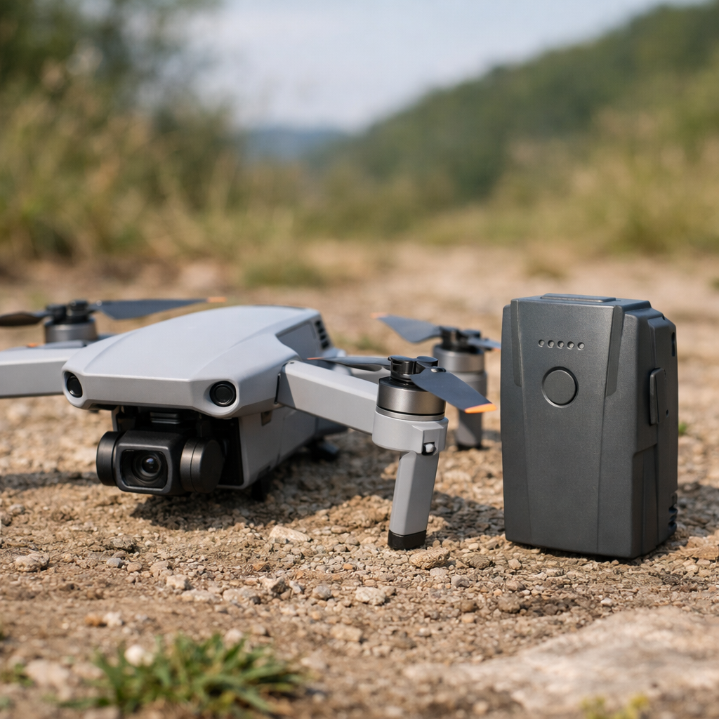
The rapid expansion of civilian and commercial drone operations has introduced new challenges in flight safety, asset protection, and post-incident recovery. Among these challenges, locating a drone that has lost power mid-flight remains one of the most common and frustrating scenarios for operators. A drone with a dead battery becomes a passive object influenced solely by gravity, wind, terrain, and its last recorded momentum. Unlike drones that land through automated protocols, a dead-battery drone may descend unpredictably, lose telemetry abruptly, and provide only partial data for recovery. As drone usage increases in photography, surveying, logistics, and recreation, understanding how to systematically locate a drone after battery failure becomes essential for minimizing financial loss and ensuring operational continuity.
This paper provides a comprehensive, academically structured methodology for locating drones with dead batteries. It integrates telemetry analysis, GPS interpretation, environmental modeling, visual-data extraction, and ground-search protocols. The goal is to equip operators with a scientifically grounded framework that increases recovery success rates while reducing search time and uncertainty.
2. Failure Modes Leading to Dead-Battery Loss
Battery failure rarely occurs in isolation. It is typically the result of interacting factors that degrade power availability or disrupt the drone’s ability to manage its remaining energy. Understanding these failure modes helps predict the drone’s final behavior before power loss.
One common cause is battery mismanagement, including insufficient pre-flight charging, aging cells, or improper storage. Lithium-polymer (LiPo) batteries degrade over time, reducing their effective capacity and increasing the likelihood of sudden voltage drops. Environmental conditions such as cold weather exacerbate voltage sag, causing the drone to shut down earlier than expected.
Another failure mode involves high-load operations, such as aggressive maneuvers, rapid ascents, or carrying heavy payloads. These activities increase current draw, accelerating battery depletion. In FPV drones, high-throttle flight can drain batteries significantly faster than predicted by onboard estimators.
GPS or RF interference can also indirectly contribute to battery failure. When a drone struggles to maintain stable positioning due to signal disruption, it may expend additional energy correcting its flight path. In extreme cases, the drone may drift into areas with poor connectivity, complicating recovery efforts once the battery dies.
Finally, software miscalibration or inaccurate battery telemetry can mislead operators about remaining flight time. If the drone reports incorrect battery percentages, pilots may unknowingly fly beyond safe limits, resulting in abrupt shutdowns.
3. Telemetry-Based Recovery Principles
Telemetry data is the most powerful tool for locating a drone after battery failure. Even when the battery dies, most drones store flight logs containing critical information such as GPS coordinates, altitude, heading, speed, and voltage trends. These data points form the foundation of a scientifically grounded search strategy.
The last GPS coordinate is the single most important datum. Because a dead-battery drone ceases powered movement, the last recorded coordinate typically lies within a predictable radius of the crash site. The radius depends on altitude, wind speed, and terrain slope.
The heading at the moment of power loss indicates the drone’s momentum vector. Even after power failure, the drone continues along this vector briefly before descending. The speed at the moment of failure determines how far it travels horizontally during the descent.
Telemetry also reveals battery voltage trends. A rapid voltage drop suggests imminent shutdown, meaning the drone likely fell close to the last coordinate. A slow decline indicates the drone may have continued flying for several seconds before losing power.
Finally, altitude determines the potential descent time. Higher altitude increases drift distance, while low altitude suggests a near-vertical drop.
4. GPS-Based Recovery When Battery Is Dead
GPS analysis begins with plotting the last known coordinate on a map. This coordinate becomes the search origin. The next step is estimating the landing radius, which depends on altitude and environmental conditions.
Battery-Failure Landing Radius Model
Battery % at Failure |
Typical Landing Radius |
Notes |
10% |
0–15 m |
Autolanding likely |
5% |
15–40 m |
Increased drift |
0% |
40–120 m |
Freefall zone |
The radius expands with altitude. A drone at 120 meters may drift significantly farther than one at 20 meters. Wind direction is equally important; even moderate winds can push a powerless drone dozens of meters horizontally.
Operators should also consider terrain features. A drone falling over a slope may roll downhill, increasing the search radius. Forested areas may trap drones in tree canopies, while urban environments introduce rooftops, balconies, and courtyards as potential landing sites.
5. Visual-Data Recovery (Last Frame Analysis)
Many drones transmit live video to the controller. When the battery dies, the final frame often contains valuable clues about the drone’s surroundings. This frame may reveal terrain type, vegetation density, water bodies, buildings, or distinctive landmarks.
Operators should analyze the final frame for:
· Ground texture (grass, dirt, pavement)
· Vegetation type (forest, shrubs, crops)
· Man-made structures (roofs, fences, roads)
· Shadows indicating time of day and orientation
· Horizon line revealing slope or elevation changes
The final frame can be cross-referenced with satellite imagery to narrow the search area. Even partial visual cues—such as a red roof or a distinctive tree line—can significantly reduce search time.
6. Search-Area Modeling
Search-area modeling integrates telemetry, environmental data, and visual cues into a coherent spatial prediction. The model begins with the last GPS coordinate and expands outward based on drift calculations.
Wind Drift Equation
D=Vwind⋅tdescent
Where:
· D = horizontal drift distance
· Vwind = wind speed at drone altitude
· tdescent = time from power loss to ground impact
If the drone was descending from 100 meters, the descent time may be 4–6 seconds. With a wind speed of 5 m/s, drift could reach 20–30 meters.
Terrain slope adds complexity. A drone landing on a steep hillside may roll downhill, increasing the effective search radius. In forested areas, canopy height must be considered; drones may be suspended above ground level.
7. Systematic Ground Search Protocol
Once the search area is modeled, operators should conduct a structured ground search. Random wandering wastes time and reduces recovery probability. A grid search is the most effective method.
Grid Search Pattern
· Divide the search area into 5×5 meter squares
· Walk each square systematically
· Use auditory cues (buzzers, beepers)
· Scan tree canopies and rooftops
· Use a flashlight for dense vegetation
Operators should also check non-obvious locations such as gutters, balconies, and hedges. In urban areas, drones often land on rooftops or behind fences, requiring permission from property owners.

8. FPV-Specific Methods
FPV drones differ from GPS-assisted drones in several ways. They often lack autonomous landing protocols and rely on pilot skill for navigation. When an FPV drone loses power, it may fall unpredictably, making recovery more challenging.
However, FPV drones frequently include self-powered buzzers that activate when the main battery disconnects. These buzzers can operate for hours, providing auditory cues for recovery. Operators should listen carefully for beeping patterns.
FPV goggles often record DVR footage, which includes the final seconds before power loss. This footage may reveal the drone’s orientation, altitude, and surroundings. Additionally, RSSI (signal strength) can help triangulate the drone’s approximate location.
9. Non-GPS Drone Recovery
Toy drones and Wi-Fi FPV drones often lack GPS modules. Recovery relies on signal-strength analysis and visual cues.
Wi-Fi Signal Strength Method
The controller or smartphone displays Wi-Fi signal strength in dBm. As the operator moves closer to the drone, signal strength increases. By walking in different directions and observing changes, the operator can triangulate the drone’s location.
Non-GPS drones typically fall near the point of power loss, making the search radius smaller. However, their lightweight frames may be carried farther by wind.
10. Case Studies
Case Study 1: Mini Series
A Mini drone loses power at 12% battery while hovering at 30 meters. Telemetry shows a slow voltage decline, suggesting the drone continued flying for several seconds. The last frame reveals a grassy field with a dirt path. The drone is found 18 meters from the last coordinate, partially hidden in tall grass.
Case Study 2: FPV Freestyle Quad
An FPV quad performing acrobatic maneuvers experiences sudden voltage sag. The DVR shows the drone flipping before losing power. The self-powered buzzer activates, allowing the operator to locate the drone in a tree canopy 40 meters from the last known position.
Case Study 3: Wi-Fi FPV Toy Drone
A toy drone loses power at low altitude. The operator uses Wi-Fi signal strength to triangulate its location. The drone is found on a rooftop after drifting slightly due to wind.
11. Prevention Strategies
Preventing dead-battery incidents is more effective than recovering from them. Operators should adopt rigorous battery-management practices, including:
· Pre-flight battery checks
· Avoiding deep discharges
· Monitoring voltage sag
· Using high-quality batteries
· Avoiding cold-weather flights
Installing GPS trackers, Bluetooth tags, or RF beacons significantly increases recovery success. Pre-flight mapping and awareness of environmental conditions also reduce risk.
12. Conclusion
Locating a drone with a dead battery requires a structured, analytical approach grounded in telemetry interpretation, environmental modeling, and systematic search techniques. By integrating GPS data, visual cues, drift calculations, and ground-search protocols, operators can significantly increase recovery success rates. As drone technology continues to evolve, the ability to understand and apply scientific recovery methods will remain essential for safe and responsible UAV operation.
A drone with a dead battery can be found by analyzing its last telemetry, GPS position, final video frame, wind drift, and terrain. Combining descent modeling with a structured grid search greatly improves recovery success, especially when using FPV buzzers, DVR footage, or Wi-Fi signal strength for non-GPS drones.
Table of Contents
- 1. Introduction
- 2. Failure Modes Leading to Dead-Battery Loss
- 3. Telemetry-Based Recovery Principles
- 4. GPS-Based Recovery When Battery Is Dead
- 5. Visual-Data Recovery (Last Frame Analysis)
- 6. Search-Area Modeling
- 7. Systematic Ground Search Protocol
- 8. FPV-Specific Methods
- 9. Non-GPS Drone Recovery
- 10. Case Studies
- 11. Prevention Strategies
- 12. Conclusion